2018 MayFly Contest
The Pendleton Contest Area
The Pendleton contest area contains a number of airspace restrictions that will require the competitor to be constantly aware of his/her location with respect to class C, D, Restricted and US sovereign airspace. The three MayFly tasks have been designed to keep pilots in the class E airspace between Ottawa & Montreal. Severe penalties will be assessed to competitors that enter class C, D, Restricted or US sovereign airspace. Competitors are encouraged to help GGC maintain a professional relationship with the appropriate airspace controlling authorities.
CONDOR Simulator Scenery
Scenery files (formatted for use in the CONDOR soaring flight simulator) have been created to help visiting pilots become familiar with the Eastern Ontario flying area.
These sceneries can be accessed HERE.
Turnpoints & Airspace
The official set of 2018 MayFly Turnpoints and Airspace (Pendleton, ON) are located at John Leibacher's World Wide Soaring Turnpoint Exchange website. The latest release is dated 09 April 2013 and can be accessed HERE.
Please read the warnings and caveats that accompany these data files.
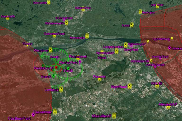
A KMZ file containing airspace and turnpoints formatted for use in Google Earth can be accessed HERE.