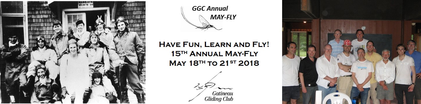
2018 MayFly Contest
Contest Area Lodging
Onsite Camping
An unlimited number of tent sites and a limited number of serviced trailer/motorhome sites are available at GGC. Please select this option on the registration form if you are planning to camp/trailer/motorhome at GGC.
Bed & Breakfast
Local B&Bs (within 1/2 hour) are listed below:
O Genet Bed & Breakfast
Gite Le Boise
Au Bois Dormant
Gite La Galerie d'en Avant Bed & Breakfast
Local Inns
Local Inns (within 1/2 hour) are listed below:
River Rock Inn
Directions to GGC (by Land)
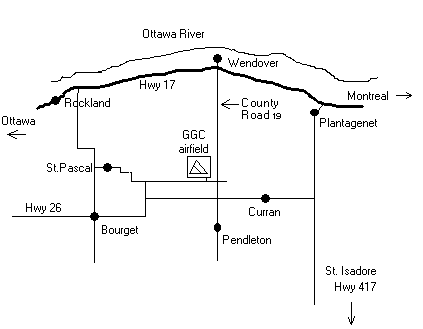
From Ottawa - take Highway 17 east to Wendover, turn right on County Road 19 (formerly known as Nine Mile Road) and continue south for approximately 9.5km to Concession Road #7. Turn right and follow the signs to the airport.
From Montreal - take Highway 40 to 417 then exit to Highway 17 at Hawkesbury, follow 17 to Wendover, turn left on County Road 19 (formerly known as Nine Mile Road) and continue south approximately 9.5km to Concession Road #7. Turn right and follow the signs to the airport.
Directions to GGC (by Air)
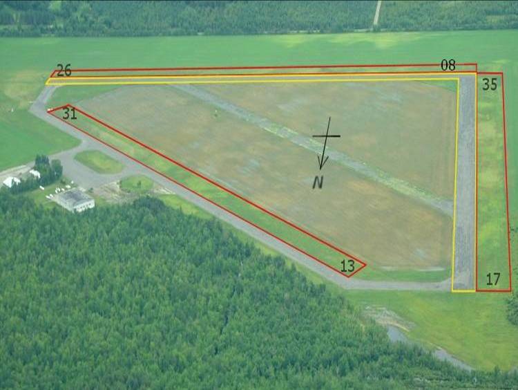
Identifier: CNF3. Located approximately 26 nautical miles northeast of Ottawa.
Coordinates: N45 deg 29' 10" W075 deg 05' 46"
Unicom: 123.3 MHz
Runway 26/08: (2550 ft) Landing on asphalt or grass. Gliders typically launch on asphalt and land on grass (south side of asphalt).
Runway 31/13: (2650 ft) Landing and takeoffs on grass on southwest side of asphalt. Asphalt of runway 31/13 is not suitable for landing or takeoff.
Runway 35/17: (2550 ft) Landings and takeoffs typically on grass on west side of asphalt/loose gravel.